
UPSC Mains 2026 GS1 Q4: model answer
What is the Fujiwhara effect? Explain its impact on the movement and intensity of tropical cyclones.
What the question wants
Define the effect (interaction of two nearby cyclones), then explain how it changes their paths and strength, with examples.
How to structure it
Intro: define the Fujiwhara effect (Sakuhei Fujiwhara, 1921) as two cyclones within about 1,400 km rotating round a common centre. Body: (1) Movement: orbit around a shared point, bent tracks, one storm flung away or pulled in, steering winds overridden; (2) Intensity: merger into one stronger system, absorption of the weaker storm, weakening through shear; (3) Examples: Hilary and Irwin (2017), Hinnamnor and Muifa (2022), twin systems over the Arabian Sea and Bay of Bengal. Conclusion: wider forecast cones and earlier warnings for IMD when paired storms form.
- 1(1) Movement: orbit around a shared point, bent tracks, one storm flung away or pulled in, steering winds overridden
- 2(2) Intensity: merger into one stronger system, absorption of the weaker storm, weakening through shear
- 3(3) Examples: Hilary and Irwin (2017), Hinnamnor and Muifa (2022), twin systems over the Arabian Sea and Bay of Bengal
Model answer
The Fujiwhara effect, named after Japanese meteorologist Sakuhei Fujiwhara (1921), is the interaction between two cyclonic vortices that come within roughly 1,400 km of each other. They begin to rotate around a common centre, anticlockwise in the northern hemisphere.
- 1Two cyclones within ~1,400 km
- 2Rotate around a common centre
- 3Tracks bend from forecast
- 4Merger, absorption or weakening
Impact on movement
- Both storms orbit a shared point, so tracks bend away from the forecast path.
- The smaller storm can be flung away or pulled in.
- Steering by upper winds is overridden for a while, making landfall harder to predict.
Impact on intensity
- Merger: two storms of similar size can combine into one stronger system.
- Absorption: the stronger cyclone absorbs the weaker one's energy.
- Weakening: outflow from one shears the other.
Examples: Hurricanes Hilary and Irwin (2017) in the eastern Pacific; Typhoons Hinnamnor and Muifa (2022). Paired storms have also formed over the Arabian Sea and Bay of Bengal.
For IMD this means wider cones of uncertainty and earlier warnings when twin systems form.
Keywords, cases and data to drop in
binary interaction common centroid merger track deviation IMD
Where most answers lose marks
- Defining it without explaining movement and intensity separately
- No example
Same theme in Prelims
Which of the following are the evidences of the phenomenon of continental drift?
- I. The belt of ancient rocks from Brazil coast matches with those from Western Africa.
- II. The gold deposits of Ghana are derived from the Brazil plateau when the two continents lay side by side.
- III. The Gondwana system of sediments from India is known to have its counterparts in six different landmasses of the Southern Hemisphere.
Select the correct answer using the code given below.
Answer (c) & explanation
All three are evidence for continental drift (c). Item I is right: the belt of ancient rocks on the coast of Brazil matches those of West Africa. Item II is right: Ghana's gold has no source rock in Ghana, but its source exists in the Brazil plateau, showing the two lands once lay side by side. Item III is right: India's Gondwana sediments have twins in six southern landmasses. So options (a), (b) and (d), which leave items out, fail.
Notice other proofs used by Alfred Wegener (1912): the "jig-saw fit" of coastlines, tillite from old glaciers, and fossils like Mesosaurus found on both sides of the Atlantic. His idea was later explained by sea-floor spreading and plate tectonics.
Answer as per the official UPSC answer key.
Consider the following statements :
Statement I : The amount of dust particles in the atmosphere is more in subtropical and temperate areas than in equatorial and polar regions.
Statement II : Subtropical and temperate areas have less dry winds.
Which one of the following is correct in respect of the above statements?
Answer (c) & explanation
Statement I is correct, Statement II is wrong (c). Statement I is right: dust in the air is highest over the subtropical and temperate belts. Statement II is wrong, because it reverses the reason: these belts have more dry winds, not fewer, and those winds lift dust from deserts and dry land, such as the Sahara, Thar and Gobi. Near the equator, heavy rain washes dust out of the air, and in polar regions, ice and snow give little dust to lift. So options (a), (b) and (d) fail.
Notice why dust matters: it acts as hygroscopic nuclei around which water condenses into clouds and rain. It also scatters sunlight, giving red sunrises and sunsets. Saharan dust even feeds the Amazon with phosphorus.
Answer as per the official UPSC answer key.
Consider the following statements :
Statement I : In January, in the Northern Hemisphere, the isotherms bend equatorward while crossing the landmasses, and poleward while crossing the oceans.
Statement II : In January, the air over the oceans is warmer than that over the landmasses in the Northern Hemisphere.
Which one of the following is correct in respect of the above statements?
Answer (a) & explanation
Both are correct and Statement II explains Statement I (a). Statement II is right: in the northern winter (January), land loses heat fast, while the oceans stay warmer, because water heats and cools slowly. Statement I follows: a given temperature line, or isotherm, is pushed south (equatorward) over the cold land and north (poleward) over the warm ocean. Options (b), (c) and (d) miss this link.
Notice the reverse in July: land is hotter, so isotherms bend poleward over land. Warm currents like the Gulf Stream and North Atlantic Drift push isotherms further north, keeping Norway's ports ice-free. In the Southern Hemisphere, with more ocean, isotherms run fairly straight.
Answer as per the official UPSC answer key.
Fresh examples from current affairs
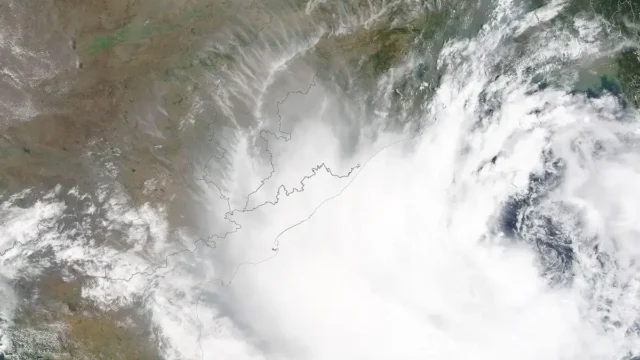
IMD launches a map-based Decision Support System for cyclone and marine warnings
On 12 October 2026 the India Meteorological Department dedicated a Cyclone Warning and Marine Weather Services Decision Support System to the nation. The WebGIS platform shows cyclone track, intensity, winds, rainfall, storm surge and district-wise warnings on one map for disaster managers and the public.
UPSC angle: Prelims: IMD, cone of uncertainty, storm surge. · Mains GS-III: early warning and disaster preparedness.
13 Oct 2026
New Doppler weather radars at Raipur and Mangaluru
Gaps in radar cover leave flash floods and thunderstorms unforecast.
UPSC angle: Prelims: Mission Mausam.
27 Nov 2025Learn the concept
Question text as printed in the official UPSC question paper: https://www.upsc.gov.in/sites/default/files/QP-CSM-26-010926-GENERAL%20STUDIES%20PAPER%20-%20I.pdf The model answer is original Battle IAS work; use it to learn structure, not to memorise.