
Chapter 12 · Topic 12.2 · Prelims + Mains2 of 3
Disaster and Environment: Cyclones, coasts, heat and fire
Key points
- A cyclone is named at 34 knots. Super cyclonic storm: 120 knots and above.
- Mangroves resist uprooting thanks to extensive roots (2004 Tsunami lesson).
- NCCR: 33.6% of the coast eroding, 26.9% accreting, 39.5% stable. West Bengal worst (60.5%).
- Heat wave considered at 40°C plains, 37°C coast, 30°C hills.
- Declared when met at 2 or more stations for 2 consecutive days.
- 35.47% of forest cover is fire prone (FSI).
Prelims box: facts and traps
| IMD category | Wind speed |
|---|---|
| Deep depression | 28-33 knots (50-61 kmph) |
| Cyclonic storm | 34-47 knots (62-88 kmph) |
| Super cyclonic storm | 120 knots and above (222 kmph and above) |
- Trap (Prelims 2026): mangroves are not paddy sites or freshwater aquaculture zones.
- Heat wave departure: 4.5°C to 6.4°C above normal. Severe: more than 6.4°C.
Cyclones, mangroves and coastal erosion
The India Meteorological Department (IMD) grades a storm by its maximum sustained surface wind, the steady wind near the ground, not gusts. A system gets a name from the list once winds reach 34 knots (IMD, Terminology on cyclonic disturbances).
| IMD category | Wind speed |
|---|---|
| Low pressure area | below 17 knots (31 kmph) |
| Depression | 17-27 knots |
| Deep depression | 28-33 knots (50-61 kmph) |
| Cyclonic storm | 34-47 knots (62-88 kmph) |
| Severe cyclonic storm | 48-63 knots (89-117 kmph) |
| Very severe cyclonic storm | 64-89 knots (118-166 kmph) |
| Extremely severe cyclonic storm | 90-119 knots (167-221 kmph) |
| Super cyclonic storm | 120 knots and above (222 kmph and above) |
Source: IMD, RSMC New Delhi, Terminology on cyclonic disturbances over the North Indian Ocean.
Mains 2024 asked what sea surface temperature rise is and how it affects tropical cyclones. Warmer seas give storms more heat and moisture to feed on.
What is sea surface temperature rise? How does it affect the formation of tropical cyclones?
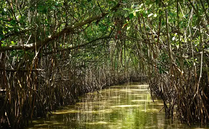
Mangroves are the coast’s living shield. They are salt-tolerant trees where rivers meet the sea.
The 2004 Tsunami showed mangroves are a reliable safety hedge against coastal disasters, because the trees are not uprooted by storms and tides, thanks to their wide, tangled roots (Prelims 2011).
The 2004 Tsunami made people realize that mangroves can serve as a reliable safety hedge against coastal calamities. How do mangroves function as a safety hedge ?
- The mangrove swamps separate the human settlements from the sea by a wide zone in which people neither live nor venture out
- The mangroves provide both food and medicines which people are in need of after any natural disaster
- The mangrove trees are tall with dense canopies and serve as an excellent shelter during a cyclone or tsunami
- The mangrove trees do not get uprooted by storms and tides because of their extensive roots
Show answer
Answer: (d) · UPSC official key
For climate resilience, mangroves matter because they withstand tidal surges and give biomass (wood, fodder, fish and honey). So they act both as natural bio-shields and as livelihood bases for rural people (Prelims 2026: 3 only, answer key provisional).
Which of the following best explain(s) the rationale for protecting mangrove ecosystems in the context of climate resilience ? 1. Mangroves reduce tidal energy and store freshwater, making them ideal sites for paddy cultivation in saline estuarine belts. 2. Their salt-sensitive roots filter seawater, making mangroves key to converting coastal land into freshwater aquaculture zones. 3. By withstanding tidal surges and offering biomass resources, mangroves function both as natural bio- shields and livelihood bases for rural communities. Select the answer using the code given below :
- 1 only
- 1 and 2
- 2 and 3
- 3 only
Show answer
Answer: (d) · UPSC provisional key (final key awaited)
Coastal erosion means the sea eating away the shore. The National Centre for Coastal Research (NCCR), Chennai studied 6,907.18 km of the mainland coastline for 1990-2018:
- 33.6% is eroding (losing land),
- 26.9% accreting (gaining land as sand piles up),
- 39.5% stable.
West Bengal has the highest share of eroding coast (60.5%), followed by Puducherry (56.2%), Kerala (46.4%) and Tamil Nadu (42.7%) (PIB, 6 April 2023). Causes named by the Ministry include more frequent cyclones, sea-level rise, harbours, beach mining and dams (PIB, 31 March 2022). Dams trap river sand that would feed beaches.
Mains 2022 asked for the causes and effects of coastal erosion in India and the techniques to manage it.
Explain the causes and effects of coastal erosion in India. What are the available coastal management techniques for combating the hazard?
Heat waves and forest fires
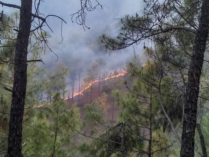
Heat waves and forest fires feed on each other. Hot, dry spells dry out leaf litter, the dead leaves on the forest floor, so it burns easily. Fires then release carbon and smoke. Both are rising as the climate warms.
IMD has clear rules for when a hot spell counts as a heat wave:
| IMD heat wave criteria | Rule |
|---|---|
| When considered | Maximum temperature at least 40°C in the plains, 37°C at coastal stations, 30°C in hilly regions |
| Heat wave (departure) | 4.5°C to 6.4°C above normal |
| Severe heat wave (departure) | >6.4°C above normal |
| Heat wave (actual, plains) | ≥45°C |
| Severe heat wave (actual, plains) | ≥47°C |
| Declared when | Met at 2 or more stations in a sub-division for 2 consecutive days; declared on the second day |
Source: IMD, FAQ on Heat Wave, IMD note of 6 April 2021 (PIB).
Wet-bulb temperature combines heat and humidity. In humid heat, sweat does not dry, so the body cannot cool. The World Bank warned that India could become one of the first places where wet-bulb temperatures routinely exceed 35°C. The official key accepts both statements: survival of animals including humans will be affected as shedding body heat through sweating becomes difficult, and peninsular India will most likely suffer from flooding, tropical cyclones and droughts (Prelims 2025: Both I and II).
The World Bank warned that India could become one of the first places where wet-bulb temperatures routinely exceed 35°C. Which of the following statements best reflect(s) the implication of the above-said report? I. Peninsular India will most likely suffer from flooding, tropical cyclones and droughts. II. The survival of animals including humans will be affected as shedding of their body heat through perspiration becomes difficult. Select the correct answer using the code given below.
- I only
- II only
- Both I and II
- Neither I nor II
Show answer
Answer: (c) · UPSC official key
IMD issues colour-coded heat warnings, like traffic lights:
- green: normal day, no action,
- yellow: heat alert, be updated,
- orange: severe heat alert, be prepared,
- red: extreme heat alert, take action (IMD note of 6 April 2021).
Mains 2022 asked about the meaning of IMD’s colour-coded weather warnings for cyclone prone areas.
Discuss the meaning of colour-coded weather warnings for cyclone prone areas given by India Meteorological Department.
The Forest Survey of India (FSI) studied forest fires detected over 17 years (2004 to 2021) and mapped fire-prone forest. The four classes from moderately to extremely fire prone add up to about 35.5% of forest cover. FSI puts total fire-prone forest at 35.47% of forest cover (FSI summary of ISFR 2021, PIB, 16 March 2023). The Ministry’s National Action Plan on Forest Fire works by informing, enabling and empowering forest-fringe communities, the villages at the forest edge, to work with Forest Departments.
| Fire-prone class (FSI study of fires, 2004-2021) | Forest cover (sq km) | % of forest cover |
|---|---|---|
| Extremely fire prone | 20,074.47 | 2.81 |
| Very highly fire prone | 56,049.35 | 7.85 |
| Highly fire prone | 82,900.17 | 11.61 |
| Moderately fire prone | 94,126.68 | 13.19 |
| Less fire prone | 4,60,638.36 | 64.54 |
Source: PIB, MoEFCC, 16 March 2023 (Release 1907678). Measured values.
What UPSC asks: Prelims: 34 knots, 40/37/30°C, 35.47% fire prone. Mains: mangroves, colour codes, 33.6% coast eroding.
Mains box: analysis and answer points
- Cyclones: sea surface temperature and cyclone formation.
- Coastal erosion: causes, effects, management techniques.
- Heat and fire: colour codes, wet-bulb risk, community fire plans.
Practice
Write an answer
In 150 words, explain the significance of Disaster and Environment with one recent example.
Flashcards (8)
Wind speed at which a cyclone is named?
34 knots.
Super cyclonic storm threshold?
120 knots (222 kmph) and above.
Why do mangroves resist storms?
Extensive roots keep them from being uprooted.
Share of mainland coast eroding (1990-
2018)? 33.6% (NCCR).
State with most eroding coast?
West Bengal (60.5%).
IMD heat wave base thresholds?
40°C plains, 37°C coast, 30°C hills.
Severe heat wave by actual temperature?
≥47°C (plains).
Extremely fire-prone forest share?
2.81% of forest cover.
In the news
- 25 Oct 2026₹1.04 crore of access and benefit-sharing money from crops shared with 27 States and 2 UTs
- 22 Oct 2026GRAP Stage I invoked in Delhi-NCR as AQI turns ‘Poor’: the 25 actions and what comes next
- 20 Oct 2026National Red List of birds: 1,211 species under assessment, 107 done in first review
- 16 Oct 2026CAQM orders PTZ cameras at all polluting industries in NCR by 30 November 2026
 Next topic · 12.3 →Disaster and Environment: Chapter test
Syllabus: GS-III · Conservation, environmental pollution and degradation, environmental impact asse…