
UPSC Mains 2013 GS Paper 1 Q21: model answer
Major hot deserts in northern hemisphere are located between 20-30 deg N latitudes and on the western side of the continents. Why?
What the question wants
Explain why the great hot deserts of the northern hemisphere lie between 20° and 30°N on the western side of continents.
How to structure it
Why? Two reasons are needed: latitude and the western side.
- The pattern
- Latitude: subtropical high
- Western side: offshore trades and cold currents
- Other factors
How to think it through
Two clues, two answers. 20–30°: the air of the Hadley cell sinks here, and sinking air warms and dries. Western side: the trade winds blow from the east, so they arrive dry on the west, and cold currents finish the job. Draw the map; it explains itself.
Model answer
The Sahara, Arabian, Thar, Sonoran and Mojave deserts all lie roughly between 20° and 30°N. The Sahara receives in places less than 25 mm of rain a year. Their location is not chance but follows from the circulation of air and water.
Why these latitudes
- Air rising at the equator moves poleward and sinks at about 30° in the Hadley cell, creating the subtropical high-pressure belt.
- Sinking air is compressed and warmed, so it becomes dry and stable; clouds cannot form.
- Clear skies give intense heating by day and strong cooling at night.
Why the western side
- Trade winds blow from east to west. By the time they reach the western margins they have lost moisture over the land, or they blow offshore.
- Cold ocean currents flow along western coasts: the Canary current off the Sahara, the California current off the Sonoran. They cool the air from below, making it stable, so fog forms but no rain.
- On the eastern sides, onshore trade winds and warm currents (Gulf Stream, Kuroshio) bring rain, so Florida and southern China are wet at the same latitudes.
Other factors
- Rain-shadow effects (the Sierra Nevada for the Mojave).
- Distance from the sea and continental size (the Sahara's interior).
The southern hemisphere repeats the pattern (Atacama, Namib, Kalahari and the Great Australian deserts) alongside the Humboldt, Benguela and West Australian currents, which proves the global logic.
Draw: A continent outline with trade-wind arrows, a cold current on the west and the desert band between 20° and 30°.
Keywords, cases and data to drop in
Hadley cell, subtropical high, adiabatic warming, offshore trades, Canary and California currents, Atacama, Namib.
Where most answers lose marks
- Giving only the subtropical high. The question also asks 'why the western side'.
Related Mains PYQs
- Describe the characteristics and types of primary rocks. UPSC 2022 · GS-I
- Discuss the meaning of colour-coded weather warnings for cyclone prone areas given by India Meteorological Department. UPSC 2022 · GS-I
- What are the forces that influence ocean currents? Describe their role in fishing industry of the world. UPSC 2022 · GS-I
- The troposphere is a very significant atmospheric layer that determines weather processes. How? UPSC 2022 · GS-I
Fresh examples from current affairs
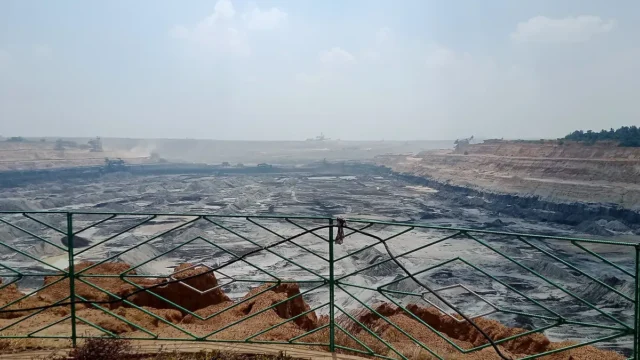
Neyveli, Tiruchirappalli and Atacama: Indian scientists identify Martian analogue sites
Scientists at the University of Kerala, using a laser Raman spectrometer funded under DST-FIST, have identified two minerals that make some places on Earth useful ‘Martian analogue’ sites, DST said on 16 October 2026. Melanterite was found in the lignite of Neyveli, Tamil Nadu. Gypsum was found in the Atacama Desert of Chile and in the Tiruchirappalli Badlands. Both are hydrous sulphates that record how water and rock interacted.
UPSC angle: Prelims: minerals, Raman effect, Atacama. · Mains GS-III: space science and research capacity.
16 Oct 2026
Ancient Gondwana wildfires recorded in Indian coal
BSIP (DST) researchers reported molecular evidence of massive wildfires in Gondwana forests nearly 250 million years ago. Using palynofacies analysis with Raman and FTIR spectroscopy on Godavari Valley Coalfield sediments, they separated high- and low-intensity fire-derived microcharcoal from other opaque particles. The study is in Geological Journal (Wiley).
UPSC angle: Prelims: Gondwana vs Tertiary coal.
25 May 2026
Aravalli Hills: Centre explains move to a uniform definition
The definition decides which hills can be mined. That is why environmental groups are watching closely.
UPSC angle: Prelims: Aravallis. · Mains: Mining vs ecology.
21 Dec 2025Learn the concept
Question text as printed in the official UPSC Civil Services (Main) question paper. The model answer is original Battle IAS work; use it to learn structure, not to memorise.
Want every PYQ in one place? See the Battle IAS PYQ Book.