
Ocean Currents: Causes, Warm and Cold Currents of Each Ocean, Gyres, Thermohaline Circulation and Effects on Climate (UPSC Notes + PYQs)

UPSC has already asked about this. Read the story with these questions in mind.
What drives currents
- Primary forces: solar heating (water expands near the equator, so sea level is slightly higher there), wind (friction drags surface water; trade winds and westerlies set the big loops), gravity, and the Coriolis force (deflects water to the right in the northern hemisphere and to the left in the southern).
- Secondary forces: differences in water density due to temperature and salinity, which drive deep currents.
- Shape of coastlines and the ocean floor deflects and splits currents.
Rotation of the Earth, wind and density all influence currents; the Earth’s revolution does not, as Prelims 2012 tested.
- Planetary windsDrag surface water
- Coriolis forceDeflects flow
- TemperatureWarm water expands
- SalinitySalty water is denser
- GravityPulls water downslope
- Coastline shapeSplits and deflects
Gyres: the big loops
In each ocean basin, trade winds push water west near the equator and westerlies push it east in mid-latitudes. With the Coriolis force and the continents, this forms large circular gyres: clockwise in the northern hemisphere, anticlockwise in the southern. The North Atlantic gyre encloses the calm, weed-covered Sargasso Sea. Garbage patches, like the Great Pacific Garbage Patch, collect in gyre centres.
Major currents
| Ocean | Warm currents | Cold currents |
|---|---|---|
| North Atlantic | Gulf Stream, North Atlantic Drift, North Equatorial | Labrador, Canary, East Greenland |
| South Atlantic | Brazil, South Equatorial | Benguela, Falkland |
| North Pacific | Kuroshio, North Pacific Drift, Alaska | California, Oyashio (Kurile) |
| South Pacific | East Australian | Humboldt (Peru) |
| Indian Ocean | Agulhas, Mozambique, South Equatorial | West Australian |
| Southern Ocean | – | Antarctic Circumpolar (West Wind Drift) |
The Indian Ocean: currents that reverse
The northern Indian Ocean is closed off by Asia, so monsoon winds control its surface currents. In summer the South-West Monsoon Current flows clockwise and the Somali Current flows north along East Africa, bringing upwelling of cold water off Somalia and Oman. In winter the North-East Monsoon Current flows anticlockwise from east to west. South of the equator the pattern is a normal anticlockwise gyre: South Equatorial, Agulhas, West Australian.
Thermohaline circulation
In the North Atlantic near Greenland and in the Weddell Sea, sea water becomes cold and salty (salt is left behind as sea ice forms), sinks, and spreads along the ocean floor. Water rises elsewhere and returns at the surface. This slow “global conveyor belt” takes about a thousand years for a full loop. The Atlantic part, the AMOC (Atlantic Meridional Overturning Circulation), carries heat north and keeps western Europe mild; the IPCC says it is very likely to weaken this century as melting ice freshens the North Atlantic.
- 1Cold, salty water sinks near Greenland and Antarctica
- 2Deep water spreads along the ocean floor
- 3Slow rise (upwelling) in the Indian and Pacific Oceans
- 4Warm surface water flows back to the North Atlantic
- 5Cycle repeats over about a thousand years
Effects
- Climate: the North Atlantic Drift keeps Norway’s ports ice-free; cold currents cool and dry coasts.
- Deserts: cold currents on western coasts stabilise air and reduce rain, helping form the Atacama (Humboldt), Namib (Benguela), and parts of the Sahara (Canary).
- Fog and fishing grounds: where warm and cold currents meet, plankton thrive and fog forms: Grand Banks off Newfoundland (Gulf Stream and Labrador), off Japan (Kuroshio and Oyashio).
- Upwelling along cold-current coasts (Peru) brings nutrients and rich fisheries; its weakening during El Niño hurts fish catch.
- Navigation and pollution: ships use currents; oil spills and plastics spread with them.
Ekman transport and upwelling, step by step
When wind blows over the sea, it drags the top layer of water, but the Coriolis force bends that layer to the right in the northern hemisphere (left in the southern). Each deeper layer is moved by the one above it and is bent a little more and moves a little slower, forming the Ekman spiral. Averaged over the whole wind-driven layer, the net movement of water, called Ekman transport, is at about 90 degrees to the wind. Along the coasts of Peru, California, Namibia and north-west Africa, winds blowing parallel to the shore push surface water offshore. Cold, nutrient-rich water rises from below to replace it. This coastal upwelling supports some of the richest fisheries on Earth: the Peruvian anchoveta fishery is among the largest single-species fisheries in the world. Upwelling also happens along the Somali and Arabian coasts during the summer monsoon and, more weakly, off Kerala, where it feeds the oil sardine shoals that local fishers depend on.
Currents, El Niño and the Indian Ocean Dipole
Normally the trade winds pile warm water in the western Pacific near Indonesia, while upwelling keeps the eastern Pacific off Peru cool. During El Niño, the trade winds weaken, warm water spreads east, upwelling off Peru weakens, and fish catches fall. Rain shifts east with the warm water, and India’s monsoon is often weaker; 2002, 2009 and 2015 were El Niño years with poor rainfall. La Niña is the opposite, with stronger trade winds and colder eastern Pacific water. The Indian Ocean Dipole is a similar see-saw in the Indian Ocean: in a positive IOD the western Indian Ocean is warmer than the eastern, which tends to help the Indian monsoon, as in 2019. Both depend on currents and winds working together, which is why the IMD watches them before issuing its monsoon forecast.
- Strong trade winds blow east to west
- Warm pool near Indonesia
- Strong upwelling off Peru, rich fishing
- Usually a good Indian monsoon
- Trade winds weaken or reverse
- Warm water spreads to the east Pacific
- Upwelling weakens, fish catch falls
- Often a weaker Indian monsoon
How currents are measured
Sailors once tracked currents by the drift of ships and floating bottles. Today satellites measure sea surface height and temperature, from which currents can be worked out. The international Argo programme, started in 2000, keeps nearly 4,000 floats drifting through the oceans; each dives to about 2,000 m and rises again, recording temperature and salinity. India contributes Argo floats and moored buoys through the Indian National Centre for Ocean Information Services (INCOIS), Hyderabad, under the Ministry of Earth Sciences. INCOIS uses this data for ocean state forecasts, potential fishing zone advisories sent to fishers, and tsunami warnings. The Deep Ocean Mission (2021) adds further capacity to study the seas around India.
Currents and fishing grounds
The world’s richest fishing grounds lie where warm and cold currents meet, such as the Grand Banks off Newfoundland (Gulf Stream and Labrador) and the waters off Japan (Kuroshio and Oyashio), because mixing brings nutrients to the surface and feeds plankton.
PYQ trend
Prelims asked the factors influencing currents (2012) and the reasons for desert belts (2011), where cold currents are a key point. Mains links currents to climate, fisheries and sea level; draw a world sketch with a few labelled currents.
Ocean Currents: UPSC angle
For UPSC CSE
Prelims: name and location of currents, causes, effects. Mains GS-I: currents and climate, fisheries, deserts.
Ocean Currents UPSC PYQs (Prelims)
Questions UPSC has actually asked, from the official papers. Pick an option to check yourself.
Consider the following factors :
– 1. Rotation of the Earth
– 2. Air pressure and wind
– 3. Density of ocean water
– 4. Revolution of the Earth
Which of the above factors influence the ocean currents?
Ocean currents are driven by winds (shaped by pressure belts), differences in density (temperature and salinity) and are deflected by the Coriolis force from the Earth’s rotation. The Earth’s revolution round the Sun does not move currents. Answer as per the official UPSC key · Battle IAS PYQ bankAnswer (b) & why
Mains PYQs on this topic
No UPSC Mains question from 2023-2026 is directly on this topic. Older papers (2013-2022) will be added as the Mains bank grows.
Quick quiz
Which is a cold current?
Off south-west Africa.Answer (c)
The Grand Banks fishing ground lies where the Gulf Stream meets the
Off Newfoundland.Answer (b)
Which current reverses direction with the monsoon?
North Indian Ocean.Answer (a)
FAQs
Why do warm currents flow along eastern coasts?
Trade winds pile up warm water on the western side of ocean basins, which is the eastern side of continents.
What is the AMOC?
The Atlantic Meridional Overturning Circulation, part of the thermohaline system that carries heat to the North Atlantic.
How do cold currents create deserts?
They cool the air above, making it stable and reducing rainfall on nearby coasts.
What is upwelling?
The rise of cold, nutrient-rich deep water to the surface, common along western coasts with offshore winds.
Does the Earth’s revolution affect currents?
No. Rotation (through the Coriolis force) does, revolution does not.
What is Ekman transport?
The net movement of the wind-driven surface layer of the ocean at about 90 degrees to the wind direction, to the right in the northern hemisphere, caused by the Coriolis force.
Spotted an error? Tell us. We correct within 48 hours.
Image: https://commons.wikimedia.org/wiki/File:Gulf_Stream_Sea_Surface_Currents_and_Temperatures_NASA_SVS.jpg
How to use this in Mains
If asked: Explain the influence of ocean currents on climate and fishing grounds. (GS-I)
Quote: “Fog and fishing grounds: where warm and cold currents meet, plankton thrive and fog forms: Grand Banks off Newfoundland (Gulf Stream and Labrador), off Japan (Kuroshio and Oyashio).”
Use it: Ready examples for the fishing-grounds part.
In the news
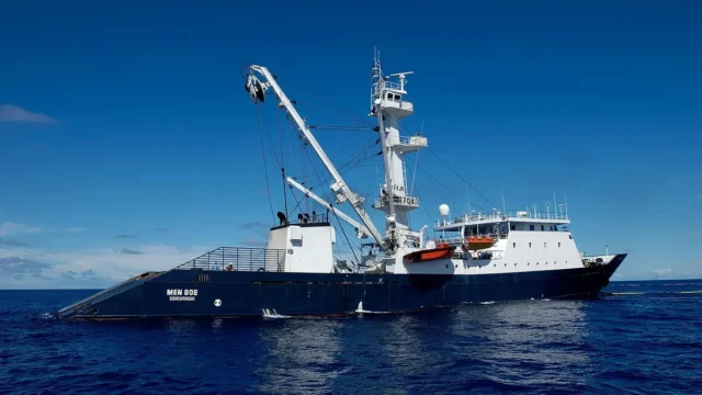
India to accede to the Southern Indian Ocean Fisheries Agreement (SIOFA)
On 14 October 2026 the Centre approved India's accession to the Southern Indian Ocean Fisheries Agreement. India, a Cooperating Non-Contracting Party since 2022, will become a full Contracting Party. Indian vessels can then fish squids, toothfish, alfonsino and other non-migratory stocks in the SIOFA area and join its scientific and compliance bodies.
14 Oct 2026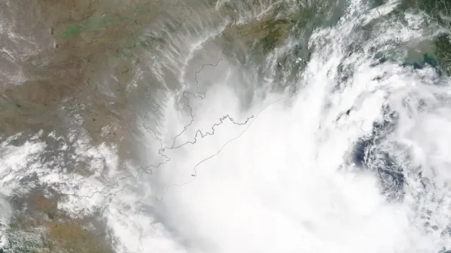
IMD launches a map-based Decision Support System for cyclone and marine warnings
On 12 October 2026 the India Meteorological Department dedicated a Cyclone Warning and Marine Weather Services Decision Support System to the nation. The WebGIS platform shows cyclone track, intensity, winds, rainfall, storm surge and district-wise warnings on one map for disaster managers and the public.
13 Oct 2026
Auction launched for two offshore polymetallic nodule blocks in the Andaman Sea
On 1 October 2026 the Ministry of Mines launched the auction of two offshore mineral blocks in the Andaman Sea, Sewell Rise-01 and West Sewell Ridge-01 off Great Nicobar, for Composite Licence. Together they cover over 1,632 sq km and hold polymetallic nodules and crusts with cobalt, nickel, manganese, copper and rare earth elements.
1 Oct 2026
ORV Sagar Manthan, indigenous ocean research vessel, launched at Kolkata
On 9 September 2026 ORV Sagar Manthan, an ocean research vessel designed and built by GRSE for the National Centre for Polar and Ocean Research, was launched at Kolkata. Built at about ₹840 crore under the Deep Ocean Mission, it will work even in the Southern Ocean, has a 30-year design life and will replace the 43-year-old ORV Sagar Kanya.
9 Sep 2026