
UPSC Prelims 2012 · GS Paper I: Consider the following factors :1. Rotation of the Earth2. Air pressure and wind3. Density…
Consider the following factors :
- 1. Rotation of the Earth
- 2. Air pressure and wind
- 3. Density of ocean water
- 4. Revolution of the Earth
Which of the above factors influence the ocean currents?
Answer (b) & explanation
Factors 1, 2 and 3 are correct (b). The Earth's rotation creates the Coriolis force, which deflects currents to the right in the north and left in the south, shaping gyres (1). Air pressure and winds, such as the trade winds and westerlies, drag surface water along (2). Differences in density, caused by temperature and salinity, drive deep thermohaline circulation (3). Item 4 is wrong: the Earth's revolution round the Sun gives seasons but does not move currents. So (a), (c) and (d) fail.
Notice the related ideas: the global 'conveyor belt', the AMOC, which scientists warn is weakening, and the Indian Ocean's monsoon-driven reversal of currents. Coastline shape and the sea floor also steer currents. Trap: revolution and rotation are easily confused.
Answer as per the official UPSC answer key.
Learn the concept
Same theme in UPSC Mains
- MAINS UPSC Mains 2026 · GS Paper III · Q19Separatist movements have been one of the major factors contributing to militancy and instability in Jammu & Kashmir (J & K). Bring out actions taken by…
- MAINS UPSC Mains 2026 · GS Paper III · Q4Explain the factors responsible for inefficiency of agri-produce marketing. How e-commerce helps to reduce inefficiency of agri-produce marketing? Explain.
- MAINS UPSC Mains 2025 · GS Paper III · Q13Examine the factors responsible for depleting groundwater in India. What are the steps taken by the government to mitigate such depletion of groundwater ?
Related questions from other years
Ships from which of the following countries have to cross the Strait of Hormuz to reach out to the Indian Ocean ?
- 1. Bahrain
- 2. Syria
- 3. Qatar
- 4. Egypt
Select the answer using the code given below :
Answer (b) & explanation
Bahrain and Qatar must cross the Strait of Hormuz (b). The Strait of Hormuz, between Iran and Oman, is the only sea exit from the Persian Gulf. Items 1 and 3 are right: Bahrain and Qatar lie wholly inside the Gulf, so their ships must pass it. Item 2 is wrong: Syria is on the Mediterranean. Item 4 is wrong: Egypt reaches the Indian Ocean through the Suez Canal and the Red Sea. So options (a), (c) and (d) fail.
Notice its importance: about a fifth of the world's oil passes through Hormuz, and much of India's crude and LNG (Qatar is a top LNG supplier). Iran's threats to close it raise prices. The UAE's pipeline to Fujairah and Saudi pipelines to the Red Sea help bypass it.
Answer as per the official UPSC answer key.
Tungurahua Volcano, which was declared a Global Geopark by UNESCO in 2025, is situated in which one among the following countries ?
Answer (a) & explanation
Tungurahua is in Ecuador (a). Tungurahua, meaning "throat of fire", is an active stratovolcano in the Andes of central Ecuador, above the town of Baños. UNESCO named the area around it a Global Geopark in 2025. Options (b), (c) and (d), Peru, Bolivia and Colombia, are wrong, though the Andes pass through all of them too.
Notice Ecuador's other famous volcanoes: Cotopaxi, one of the highest active volcanoes, and Chimborazo, whose summit is the point farthest from Earth's centre, because of the equatorial bulge. Ecuador also owns the Galápagos Islands. A Global Geopark honours geological heritage; India has none yet, though sites like Lonar have been proposed.
Answer as per the official UPSC answer key.
With reference to the climate of Andaman and Nicobar Islands, which of the following statements is/are correct ?
- 1. The climate can be defined as a humid, tropical coastal climate.
- 2. It receives rainfall from both South-west monsoon and North-east monsoon.
- 3. Maximum precipitation is between December and May.
Select the answer using the code given below :
Answer (b) & explanation
Statements 1 and 2 are correct (b). Statement 1 is right: the islands lie close to the equator in the Bay of Bengal, so they are hot and humid all year, a tropical coastal climate. Statement 2 is right: they get rain from both the south-west and north-east monsoons, from about May to December. Statement 3 is wrong: January to April is the driest part of the year, so maximum rain is not between December and May. So options (a), (c) and (d) fail.
Notice the islands' features: Barren Island, India's only active volcano; Saddle Peak, the highest point; and Indira Point, India's southernmost tip. Rich tropical evergreen forests cover them, and cyclones often form nearby.
Answer as per the official UPSC answer key.
Which of the following geographical features or phenomena is/are associated with the Peninsular Block of India ?
- 1. Submergence of parts of the western coast due to tectonic activity
- 2. Presence of residual mountain ranges such as the Veliconda hills and Mahendragiri hills
- 3. Deep, V-shaped river valleys formed by fast-flowing rivers
Select the answer using the code given below :
Answer (b) & explanation
Features 1 and 2 belong to the Peninsular Block (b). The Peninsula is an old, stable block. Item 1 is right: faulting submerged parts of the west coast. Item 2 is right: long erosion left residual hills such as the Veliconda and Mahendragiri. Item 3 is wrong: Peninsular rivers are mature, with broad, shallow valleys; deep V-shaped valleys belong to the young Himalayan rivers. So options (a), (c) and (d) fail.
Notice other Peninsular traits: Gondwana coal, Deccan Traps basalt, rift valleys of the Narmada and Tapi, which flow west into the Arabian Sea, and old block mountains like the Aravallis, among the world's oldest. Rivers here are rain-fed, not snow-fed.
Answer as per the official UPSC answer key.
In the news since
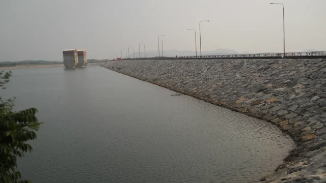
Pumped storage hydropower: India’s roadmap for 100 GW of ‘water batteries’ by 2035-36
A PIB backgrounder of 19 October 2026 explains how pumped storage projects (PSPs) will store solar and wind power for India’s grid. India runs 7.43 GW of pumped storage today, is building 15.87 GW more and has an assessed potential of 345.38 GW. A roadmap aims to add about 100 GW between 2025-26 and 2035-36.
19 Oct 2026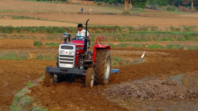
Khet Bachao Abhiyan: Centre reviews 22 October to 30 November farm campaign with States
On 17 October 2026 Union Agriculture Minister Shivraj Singh Chouhan reviewed preparations for the Khet Bachao Abhiyan with agriculture ministers of 11 States and UTs. The campaign runs from 22 October to 30 November 2026. About 4,150 teams of Krishi Vigyan Kendra and ATMA staff, with over 12,000 scientists and officials, plan around 1.5 lakh meetings with farmers on soil health, crop residue, balanced fertiliser use and key schemes.
17 Oct 2026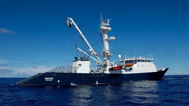
India to accede to the Southern Indian Ocean Fisheries Agreement (SIOFA)
On 14 October 2026 the Centre approved India's accession to the Southern Indian Ocean Fisheries Agreement. India, a Cooperating Non-Contracting Party since 2022, will become a full Contracting Party. Indian vessels can then fish squids, toothfish, alfonsino and other non-migratory stocks in the SIOFA area and join its scientific and compliance bodies.
14 Oct 2026