
UPSC Mains 2021 GS Paper 3 Q8: model answer
Discuss about the vulnerability of India to earthquake related hazards. Give examples including the salient features of major disasters caused by earthquakes in different parts of India during the last three decades.
What the question wants
Discuss India's vulnerability to earthquakes, with salient features of major earthquakes in different regions over the last three decades.
How to structure it
Vulnerability, then examples by region.
- Why India is vulnerable
- Major earthquakes
- Common lessons
How to think it through
Indian plate moving north ~5 cm/yr into Eurasia; Himalaya; ~59% area moderate to severe; Delhi zone IV; Kutch and NE zone V. Examples: Latur 1993 (M6.2, ~10,000 dead, stable continental region, night, stone houses); Jabalpur 1997 (M5.8); Chamoli 1999 (M6.6); Bhuj 2001 (M7.7, ~20,000 dead, Republic Day, apartments collapsed in Ahmedabad); Kashmir 2005 (M7.6, mainly Pakistan, ~1,300 in India); Sikkim 2011 (M6.9, landslides); Manipur 2016 (M6.7). Lessons: building quality, soft storeys.
Model answer
India sits on a plate that is pushing into Asia at about 5 cm a year, raising the Himalaya and storing strain along faults. About 59% of India's land is prone to moderate to severe earthquakes.
Why India is vulnerable
- Himalayan arc and the North-East in the highest seismic zone.
- Kutch and parts of peninsular India also active.
- Dense, unplanned cities such as Delhi in zone IV.
- Weak, non-engineered buildings.
Major earthquakes
- Latur, Maharashtra (1993): magnitude about 6.2, in a 'stable' region; struck at night, collapsing heavy stone houses; about 10,000 dead.
- Chamoli, Uttarakhand (1999): magnitude 6.6; landslides blocked roads.
- Bhuj, Gujarat (2001): magnitude 7.7 on Republic Day; about 20,000 dead; high-rise apartments collapsed in Ahmedabad, 300 km away.
- Kashmir (2005): magnitude 7.6; heavy damage in Uri and Kupwara.
- Sikkim (2011): magnitude 6.9; landslides did most of the damage.
- Manipur (2016): magnitude 6.7 near Imphal.
Lessons
- Deaths come from building collapse: retrofitting and code enforcement matter most.
Every region has a fault; preparedness must be national.
Draw: A map of India with dots for each quake and its year.
Keywords, cases and data to drop in
Indian plate 5 cm/yr, 59% area, zones, Latur 1993, Chamoli 1999, Bhuj 2001, Kashmir 2005, Sikkim 2011, Manipur 2016, non-engineered buildings, soft storey.
Where most answers lose marks
- Giving examples older than three decades only.
Related Mains PYQs
- Discuss how the contradiction between 'rapid infrastructure development' and 'disaster-risk reduction' in ecologically-sensitive areas of India can be managed, with suitable examples. UPSC 2026 · GS-III
- "Community participation is the cornerstone of effective disaster management". Analyse this statement with suitable examples from India. Also discuss the challenges to… UPSC 2026 · GS-III
- What are Tsunamis? How and where are they formed? What are their consequences ? Explain with examples. UPSC 2025 · GS-I
- Seawater intrusion in the coastal aquifers is a major concern in India. What are the causes of seawater intrusion and the remedial… UPSC 2025 · GS-III
Fresh examples from current affairs
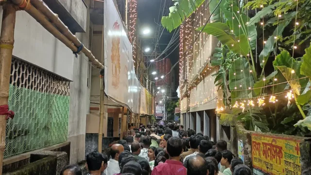
Chorbagan pandal stampede in Kolkata kills 19: what went wrong and how crowds should be managed
Nineteen people were killed and about 25 injured in a stampede at the Chorbagan Sarbojanin Durga Puja pandal in north Kolkata on the evening of 17 October 2026, during Saptami. According to police and the FIR, sudden heavy rain, weak crowd control and an announcement that the pandal could collapse set off the panic. Seven people have been arrested, and West Bengal has set up a six-member SIT.
UPSC angle: Prelims: NDMA, BNSS 163, BNS 105. · Mains GS-III: crowd management and disaster governance.
17 Oct 2026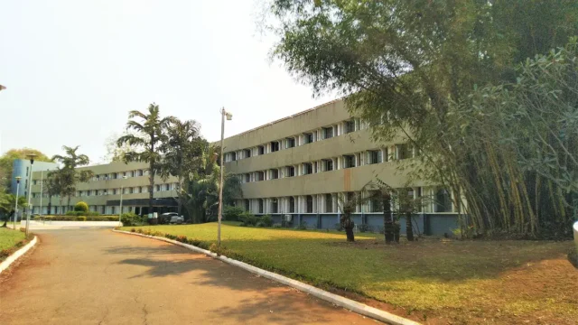
IITM Pune holds first consultation of the Climate Science into Services for India Forum
The Indian Institute of Tropical Meteorology (IITM), Pune, under the Ministry of Earth Sciences, held the first stakeholder consultation of the Climate Science into Services for India Forum (CSSIF) on 17 October 2026. More than 150 participants from over 80 institutions, including RBI, NDRF, NIDM and State climate cells, discussed what climate information each sector needs. Speakers stressed the need for a national Climate Services Information System (CSIS).
UPSC angle: Prelims: IITM, GFCS, INCOIS, NAPCC. · Mains GS-III: climate adaptation and services.
17 Oct 2026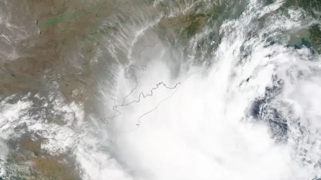
IMD launches a map-based Decision Support System for cyclone and marine warnings
On 12 October 2026 the India Meteorological Department dedicated a Cyclone Warning and Marine Weather Services Decision Support System to the nation. The WebGIS platform shows cyclone track, intensity, winds, rainfall, storm surge and district-wise warnings on one map for disaster managers and the public.
UPSC angle: Prelims: IMD, cone of uncertainty, storm surge. · Mains GS-III: early warning and disaster preparedness.
13 Oct 2026
India offers flood relief to Nepal; PM speaks to Nepal PM
On 26 August 2026 Prime Minister Narendra Modi spoke to Nepal's Prime Minister Balendra Shah and conveyed condolences on the loss of lives in floods in Nepal. He said India is ready to provide all possible humanitarian assistance, and that Indian teams are coordinating closely with Nepalese authorities on rescue and relief.
UPSC angle: Mains: India–Nepal water and flood cooperation.
26 Aug 2026Learn the concept
Question text as printed in the official UPSC Civil Services (Main) question paper. The model answer is original Battle IAS work; use it to learn structure, not to memorise.
Want every PYQ in one place? See the Battle IAS PYQ Book.